8

LEARN THE RIVER (LTR)
2025


THE MARCH AND APRIL 5 LTR HAS BEEN POSTPONED TO SOMETIME IN MAY due to river conditions and lack of information of river hazards downstream from Greens Bridge and the forcast of water to be 7 feet at Mehema/Lyons.

The location and date will be posted here when the decision is made by the Chief River Guide and Board of Directors. A general bulletin will also be sent by email.

Further information will be sent by email and also discussed at the April 23,2025 meeting.
Updated April 2, 2025
  THIS PAGE WILL BE UPDATED SOON
HOME MONTHLY MEETINGS March 25, 2024 Banquet BOARD MEMBERS Braggin' Board
Hazard Reports N Santiam River
FISH COUNTS, Water level & ODFW REPORTS      


CHECK IN AND LET GLENN KNOW IF YOU ARE PLANNING TO PARTICIPATE ! ! !

Membership in NSRGA is not required to participate.

New boaters and passengers will need to sign a Release and Liability Waiver form.

Contact GLENN at nsrga@wvi.com If you are planning participate ( month, 2025
)
Let us know if you need to be on the shuttle list,

or if you will arrange your own shuttle.

List of participants registered for the ? ? Names posted as received.= = = The following names are from the sign-up sheet gathered at the? ? 2025 meeting or recently received by email or phone call.

* = request shuttle

BOB JOHNSTON WILL DO SHUTTLE

= = = = = = = = = =

( ? ) = NOT VERIFIED YET
March 1, 2025 List updated

NOT PARTICIPATING:

This area is yet to be determined and will be updated as information received from boaters who previously cancelled their May LTR,

Michael Spurgeon
Terry Bergamo, Sr.

Greg Verharst
J Muller cancelled out.


RAMP
Launch time = 10:00 AM

BOB JOHNSTON will do the shuttle on June 1

Bob will be at the Stayton ramp around 9:00 AM and will plan to leave the Stayton ramp about 9:30 AM to shuttle back to the Mehama Ramp for the
10:00 AM launch.


The LTR on March1, 2025

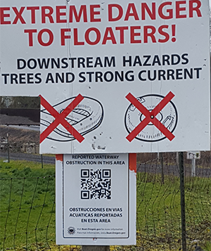
SIGN POSTED AT GREENS BRIDGE LAUNCH
Feb. 17,2024 no small rafts or inner tubes.

OK NAVIGATION FOR DRIFT BOATS.

Information in this section was posted
Shelburn (Buell/Miller) Should be ??

Greens Bridge to I-5 ramp will be checked before the March 1, 2025 LTR

* * * * * * * * * * * *

Check the Hazard Reports N Santiam River page.

WE anticipate we will have drone video of the section of the river prior to our March 1, 2025 LTR

Green's Bridge to I-5 is navigatable ? ? ? ? A reconassainse run is planned to check for hazards.

Linn County Sherriff's River Patrol report : pending

THE MARCH 16, 2024 LTR WAS A HUGE SUCCESS. GREAT WEATHER AND WATER CONDITIONS.
NO HAZARDS. CLEAR CHANNEL ALL THE WAY TO I-5.

THANK YOU BOB JOHNSTON FOR THE SHUTTLE.
MIKE FERRIS, OUR SUBSTITUTE "CHIEF RIVER GUIDE" FOR THE DAY SELECTED AN EXCELLENT SPOT FOR OUR LUNCH BREAK.

This section posted March 23, 2024

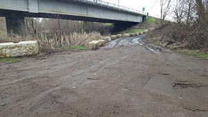
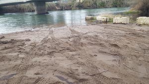
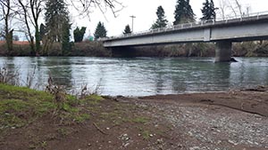
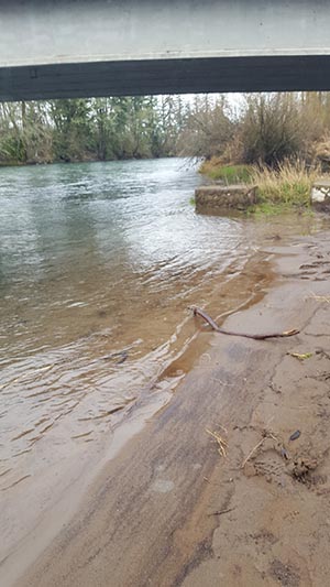
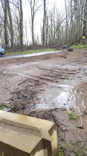
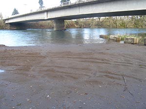
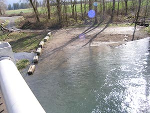
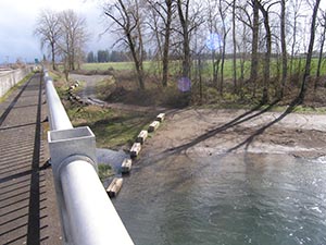
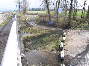
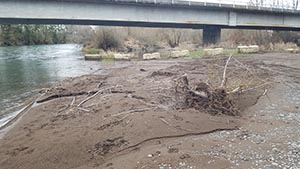
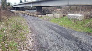
GREEN'S BRIDGE LAUNCH AREA : The following photos were taken February 16 & 17, 2024
Entrance to Green's Bridge launch area Half way down entrance
Looking upstream, launch area used to be gravel
February 17, 2024
Upstream edge of launch area
February 17, 2024
downstream edge of launch area
N end of launch Feb 17 2024

Another view near bottom barrier,
above the water line of photo on left

Upstream edge of launch area
March 12, 2024


Additional photos taken Tuesday morning March 12, 2024 will be added below, later today to compare with photos from Feb. 16 & 17.

Top of Bridge view Top of Bridge view Top of Bridge view  


Hazard sign posted at gate for small rafts and inner tubes.


Green's Bridge to confluence with N & S Santiam.
Jon Beilstein & Mike Ferris did a reconassaice run Wednesday March 13, 2024. They saw a few hazards, however none that were critical. The channel change we heard about at the confluence of the N & S Santiam was not present.
The confluence area was clear.


For those who want to add GPS directions for Buell-Miller ramp, addresst is 40510 Hess Rd. Scio OR 97574 / Buell-Miller ramp is also know as the Shelburn ramp & Hess Ramp


Photos to be added

Ready to launch boats at Mehama boat ramp May 2019


BOAT RAMPS
highlight links then right click to open link
or
Paste link into your browser

click on driving directions for additional map detail

MAPS FOR NORTH SANTIAM BOAT RAMPS:

North Santiam Boat Ramps:
https://naturalatlas.com/rivers/north-santiam-781385/boat-launches

Buell-Miller boat ramp:
https://naturalatlas.com/boat-launches/buell-miller-1642838
The boat ramp is at the end of Hess Road just north of Shelburn
note: on the driving directions - - the location is marked as Aumsville.
This is an error.

Stayton Ramp      

Stayon ramp 4-5-2019

9-24-2019
more ramp progress photos coming. Re-building this project was started Sept, 2019 re-building photos misplaced and will be added when located.
 

page updated May 30, 2024